The old path in the region are part of the indigenous cultural heritage. The paths one coming from the south from Pasto directly link to the Qhapaq nan. The Inga as decendants of the Inca came regarding to historic sources during the reign of Huayna Cápac as mitmakuna to Valle Sibundoy. These historic paths where the connection between the andean cultures and the cultures in amazon basin. In the colonial times the paths where first used by Conquistadores who searched for the El dorado in the mountains here. Later Monks with their missions. What was a horrifying barrier for the colonizers was a cultural connection for in the indigenous culture. A monk described the paths in the following:
"It was a truly risky enterprise to undertake a journey through the Putumayo region when, at the beginning of the present century to the current Prelate of the territory. An almost impassable barrier of towering mountains separated the vast territory from the rest of Colombia. If any zealous missionary adventurer was determined to overcome the obstacles that nature had accumulated, he did not succeed without great sacrifices and often at the risk of his own life. The path which communicated that savage world with the civilized one was the most original and horrifying that one can imagine; it might be said that it some evil spirit had amused itself in distributing precipices and cliffs to prevent entry into those solitudes, where savagery solitudes, where savagery was at ease. The path to Mocoa was nothing less than a series of cliffs over which one had to climb by clinging to the roots of the trees, and by holding the tips of one's feet in the cracks of the rocks, with the danger at every moment of rolling into the abyss; this without taking into account the fearsome páramo of Bordoncillo, at an altitude of 4000 metres, through a swamp with knee-deep water and a freezing temperature, where one was forced to pass. Here, strong hurricanes mixed with water violently lashed the traveller's face, making it extremely difficult to make the obligatory march along that route, which could not be saved with less than six hours of terrible suffering; in those places some daring travellers perished every year, victims of their daring " - Montclar 1924
Historic Maps
In our research we stumbled uppon the historic maps of the region where some paths are mapped by the colonizers. The maps show paths which are barelly known today but also where there where no paths at least for the spanisch regime... Following the converstations we had with people in the region these paths, especially the forgotten and overgrown ones, can be considered part of the indigenous cultural heritage and their territory.
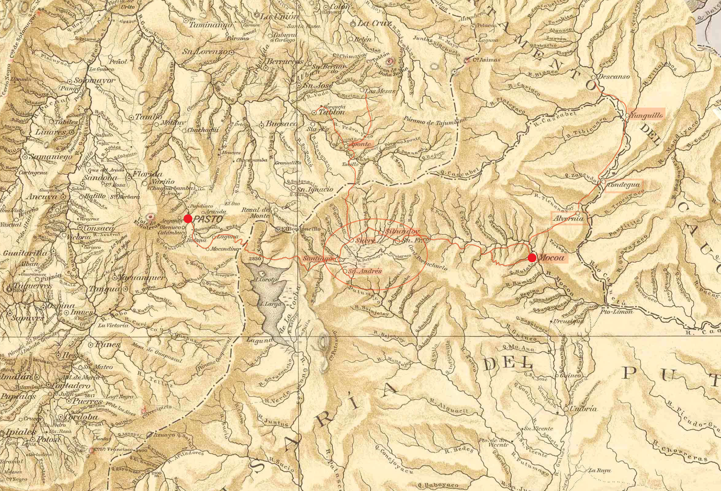
Lines in red are the paths redrawn on the map
Text in red are the texts rewritten which where barely readable in the old map
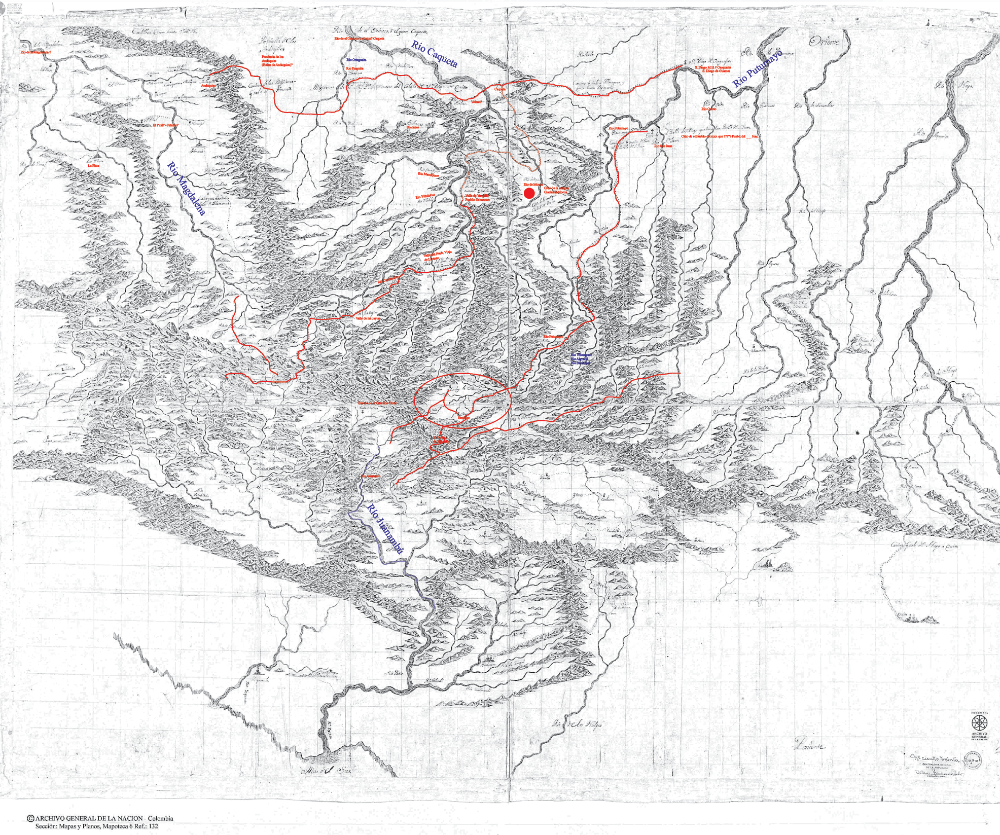
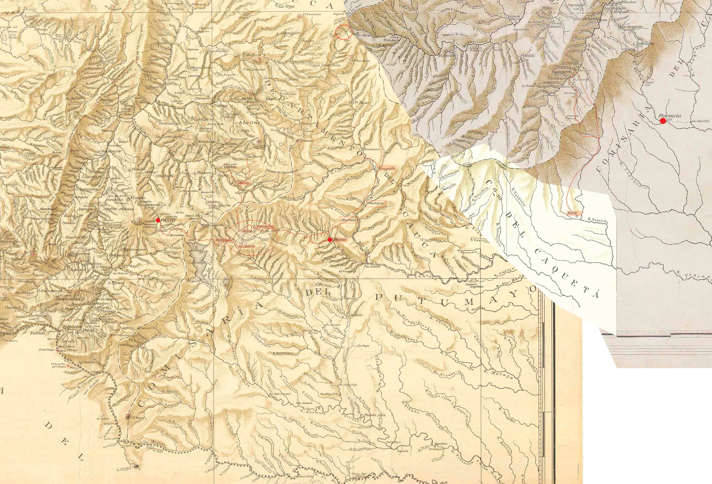
Full map page of 1700
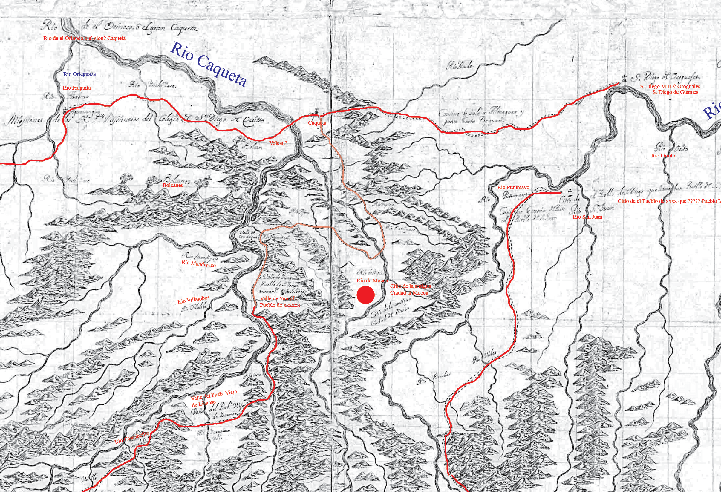
Zoom in with Mocoa in the center
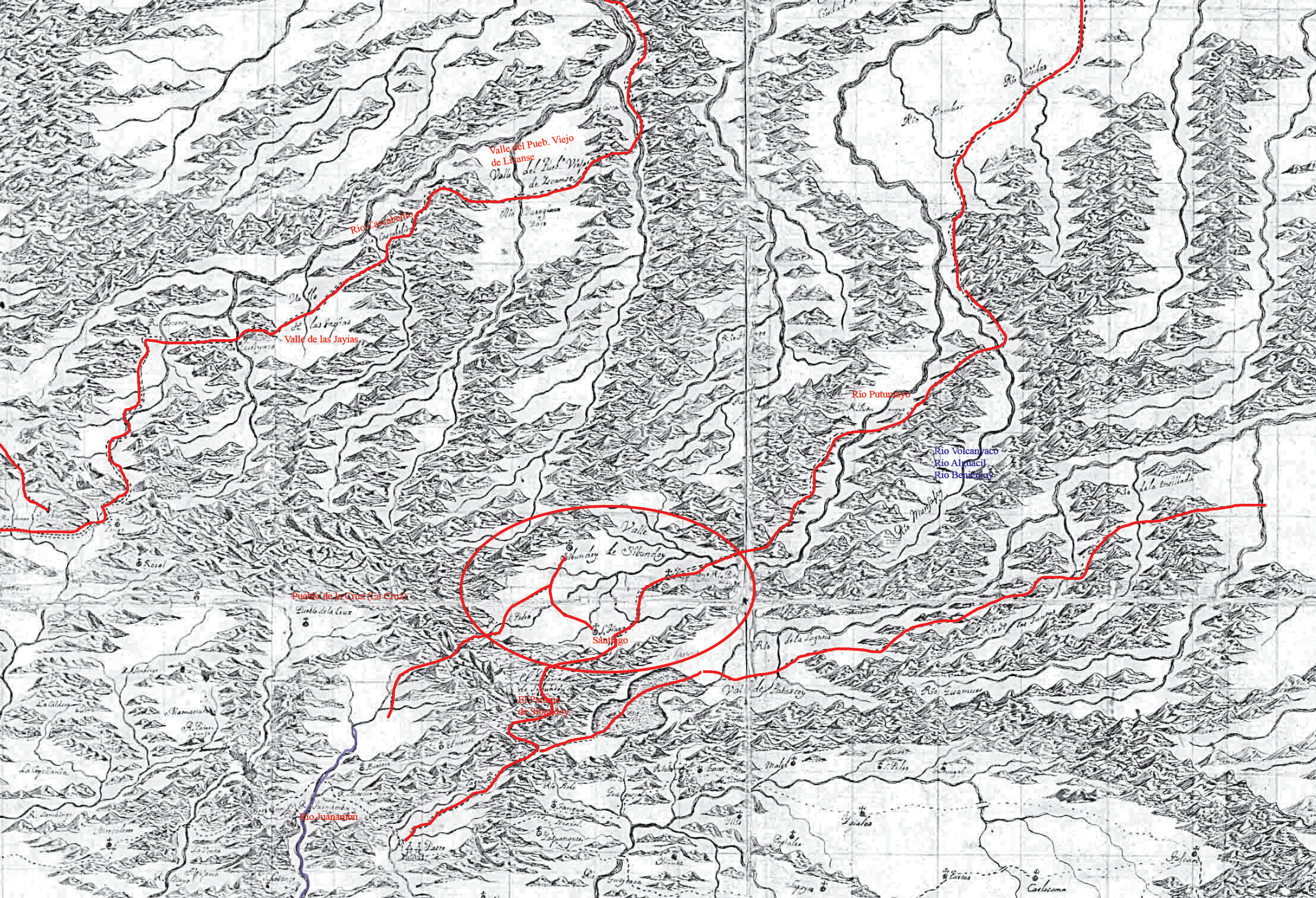
Zoom in with Valle Sibundoy in the center, on the top right you see a path following the rio Putumayo where there is no connection today
Map 1800
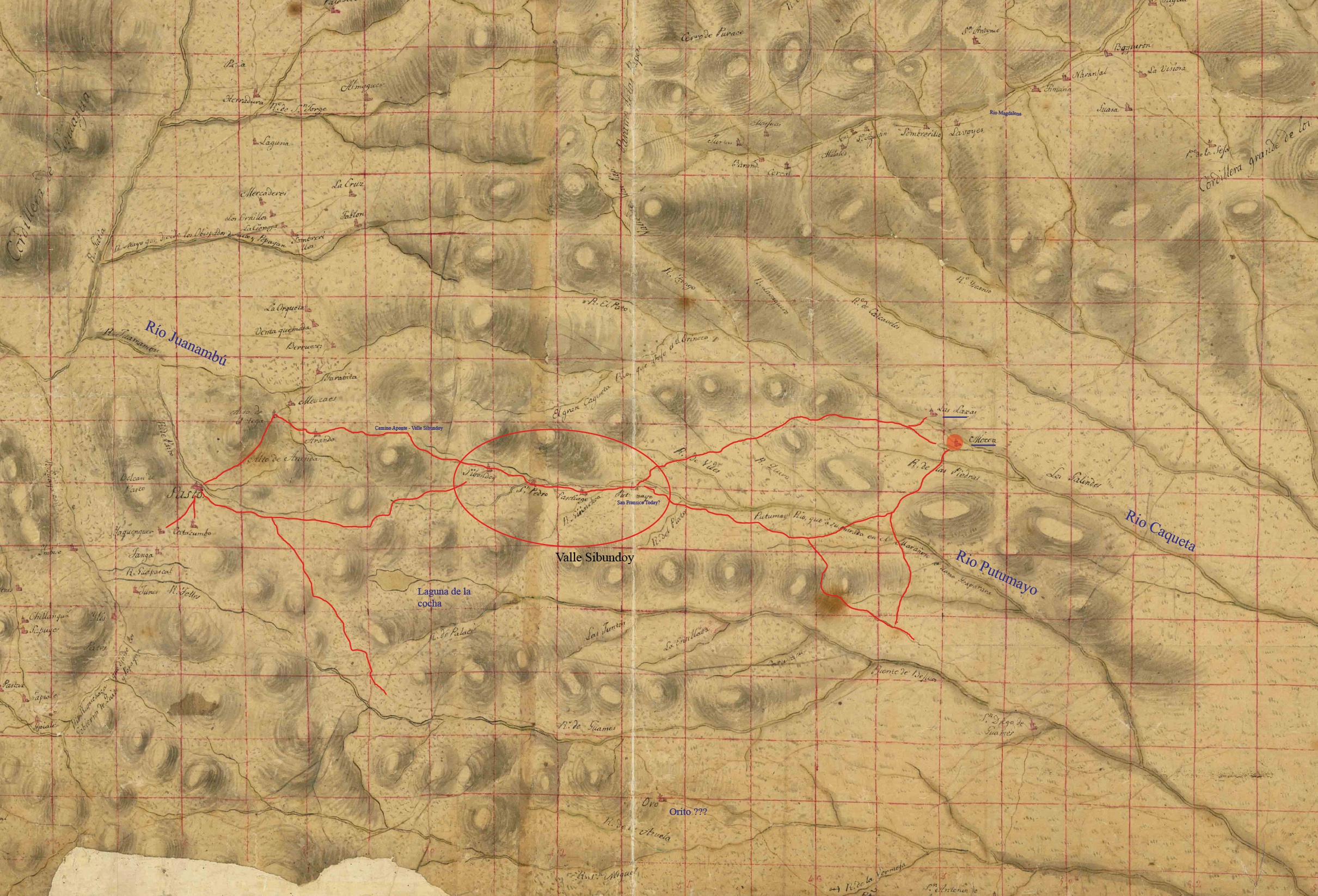
Map of 1800 also with a path following the rio Putumayo
Map of 1920s where there is no connection in the direction of Florencia in these colonial maps
Map of 1920s where the path mentioned before is missing but the ancestral path between Mocoa and San Fransico has a variation in the end